River Wyre (research & background)
Kings Scar is the local name given to a sand bank North of Fleetwood. After various comment on this, and the surrounding area, on the Wyre Archaeology forum it was decided to bring some of this data together.
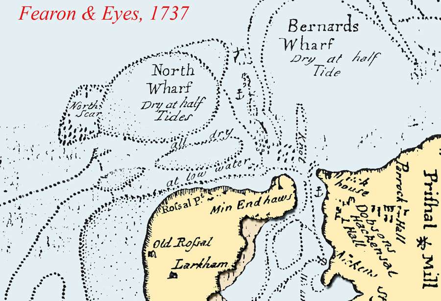
One of the earliest charts of the area was produced by Fearon & Eyes. A, very good, photocopy of the northern section is shown below:-

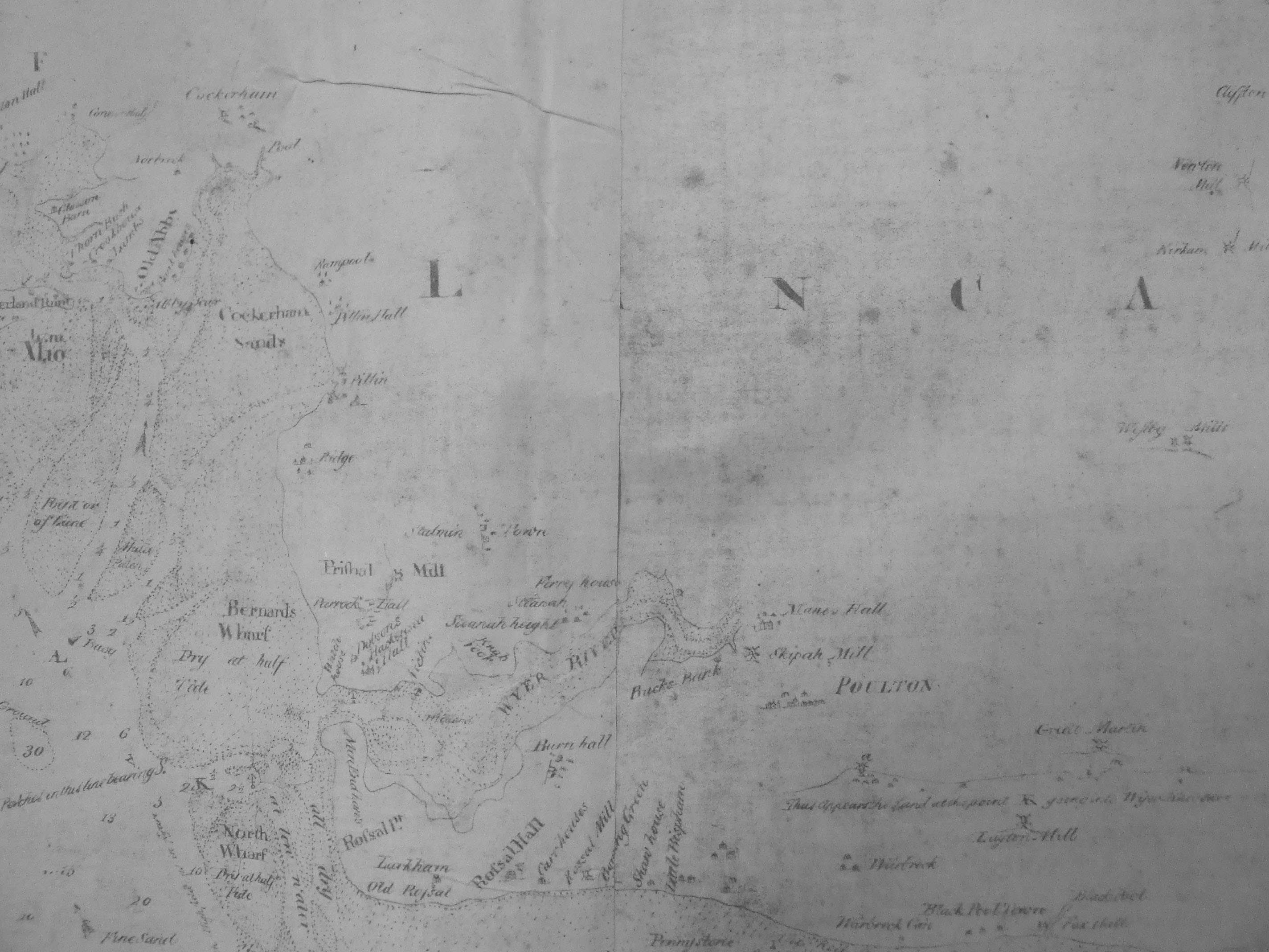
The original for the coast from the Ribble to Formby can be found in Lancashire Records Office (DDBL/24/25) but, unfortunately, the northern section is only available as a poor photocopy. This is shown below:-

When Fearon & Eyes charted the area they also produced a manuscript giving sailing details and of safe anchorages. Again this is added below. The document is difficult to read/interpret in many areas and, if any readers can give better guesses perhaps they could report these to the secretary.
A description of Wyre Between North Wharf and Cockerham sands is the entrance to Wyre Harbour, which is mostly dry at Low Water except some places hereafter mention'd. Here it flows at Hollock? at Full and Change. The water rises about 18 foot in Neap, and 26 foot in Spring Tides. This place is not subject to alter, as the Channel is narrow and mostly bounded by hard Patches on each side, as appears in the Chart, and hereafter describe'd. Towa? The lowest Patch is call'd Towa?, and never dries but in Low Ebbs. By the Directions for this Place you go between this Scar and Cockerham Sands, leaving the Scar on the Starboard hand, or rather going over a part of it. Green Scar Above this lies the Green Scar which covers in about an House? Flood in Spring Tides, but in Neap Tides does not dry. Black Scar Further up lies the Black Scar, which is a patch of Stones and Clay that the Perch stands on, joining the Main on the Starboard Hand going in. This Scar is lower between the Main and the part where the Perch stands, which part hath about 8 foot of water over it in Neap, and 17 or 18 Foot at High Water in Spring Tides. The Knot Farther up on the Starboard Hand is the Knot, which is a high and rough stony Patch. When Prishall Mill is in a line with the Watch House, you are at the lower end of this Scar; and when you see any part of the House which stands near the Watch House to the Southward of the Watch House, or Hackensea Hall shuting in with the Point of Min-end Haws, you are clear of the Knot, between it and the Main. Amongst these Patches before describ'd are several Places of 4 and 5 foot of Water; likewise between the Knot and Black Scar 2 or 3 Fathom, but so small a place and rough Ground all hereabouts, that it is not safe for a vessel to come to here. Where to lie in Wyre Harbour Abreast of the Point of Min-end Haws, between and the Kanc?, is 3 fathom at Low Water, but so small a Place and the Ground so loose that it is not safe for a Vessle to come to here; nor is there any Place in this Harbour to lie afloat in; but in several places there is good lying aground, as close in by the Min-end Haws on that side, or on Prishal side opposite to this; likewise at the Neckings a little below Hames? Hill, where Vessels generally lie, til with a Pilot they go up at Stakes?, or Buks? Bank, where Vessels of 80 or 100 Ton may go in Spring Tides. At the Enterance to Wyre Harbour, between the North Wharf and the lowest Scars, is a place of 2 and a half or 3 Fathom at Low Water, and room sufficient for a Vessel to come to here, and be shelter'd from all but N.N.E. Winds; which place may be of good service for Vessels that can't keep short, but are oblig'd up here too soon in the Tide. In such a case coming along the North Wharf, with Lancaster Castle just open to the Southward of Highfield, 'til the lower Perch which stands on the Black Scar, be in line with the pint of the Minend Haws, which Marks you may keep on when farther to the offing in 8 or 9 Fathom of Water if you please, and keeping them so, will bring you along the side of North Wharf at the out or Northermost Point of the same, in 2 Fathom at Low Water. And being past the Point, you may edge in more to the Westward along the side of North Wharfe, where you will find about 2 Fathom and a half at Low Water, where the North Perch which stands on the North Scar, is half way between Min-end Haws and Hackinsea Hall (which is the Westermost Building on the Point of Prishal side) also you will have a white House appearing about its length within the North-end of the rising Land Prishal Mill stands on, and Wharton Cragg in a line with the Highest part of Heysham Land. At this place a Vessel may lie very well 'til there is water sufficient into Wyre; or 'til the Tide be slack near High Water, which is the best going up here, with small Winds or jar? Southerly. To sail into Wyre, if from Sea, keep Lancaster and Highfield open as before in figure (AL) which will bring you along the North Wharf, 'till the Entrance of Wyre begins to open, as figure (AK) bearing S. and the Southermost Perch which stands on the Sand Hills, near the Point of Min-end Haws, be about a Handspikes Length open to the Westward of the other Perch which stands on the Black Scar, keep them so steering away near S., and taking your Soundings on the Starboard Hand (which are pretty good until near the Perch, and then steeper to, hereabouts) will bring you near the lower Perch which give a small birth to on your Starboard Hand, stand away S. as before, sterning? in with the Perch on the shore, 'til Hackensea Hall or he Barn to the Westward of the Hall touch the Point or Scar that grows on Min?-end Haws, or you see any of the House which stands near the Watch House, to the Southward of the Watch House, then you are clear of the Knot, and may stand right in with the Prishal shore, 'til you get your Soundings on that side (where Vessels may lie very adry with the Wind far Southerly or Easterly) or stand along the shore up to the Neckings between Hackensea Point and Hames? Hill, where in the Bight near the shore it is good lying aground, but there is not Water sufficient for large Vessels to come up to this place in Neap Tides. Or if you would lie on the West or Min-end Side of this Harbour, steer right up from the lower Perch as before, and close along the shore 'til any way about the point of Min-end Haws, after Burn Hall is seen without the point, where it is good lying aground, and not Tide either Ebb or Flood; here is the best place in the Harbour for a stranger to lie a Vessel on, which is very easy coming into, and out of all Danger when in it, according to the old Proverb, As safe as Wyre. Observe in coming up here, that when above the Knot, Poolton Church is seen within or to the Eastward of the Point of Minens Haws, you are about the Point of the loose shilly Bank call'd the Tranch?; and here to shun it, must either keep the Starboard Hand aboard pretty near if you design to lie on the Minend Haws side, or then stand wll over to the Prishal side, and leave the Thanch? on the Starboard hand. This Thanch?, which lies in the middle of the Channel, and is dry at Low Water, runs down with a narrow spit and becomes broader above, joining the Kirk Scar, and leaving the Channel on the Prishal side. On the Rossall or Min-end Haws side, between the Kirk Scar and the Main, runs up a hollow to Fleak? Fleet, where small Vessels may go up at High Water, above a Mile within the Point of Min-end Haws.
Obvious names like Prishal (Preesall) and Hackensea (Hackensall) have been left unchanged.
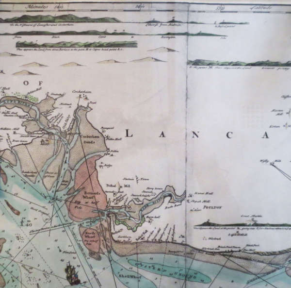
An "improved" version of the Fearon & Eyes chart has been obtained from Blackpool Libraries and we have permission to reproduce it here.

Notice that this copy contains lines of sight or bearings and this would imply a later, more complete version. The colouring could have been added at any time.
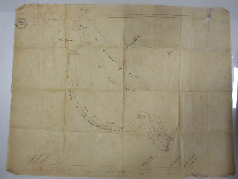
A map that has recently come to light showing the Hesketh-Fleetwood estate. It must be dated between 1824 and 1836. It is published courtesy of Lancashire Archives (DBO 363).

