Say goodbye to Arthur – 24th September
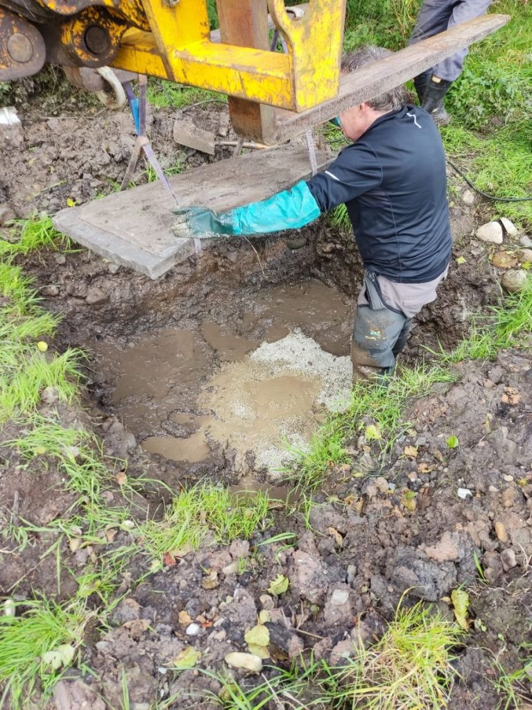
On the 24th September, 2024, our investigations into the position and structure of Arthur’s Well ended. The two Andys hired a pump to ease the removal of the surface water.
Bentonite was added to seal the various slabs together.
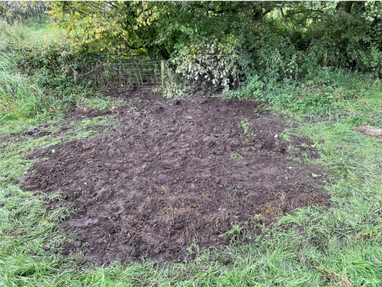
The site was finally sealed and returned, as much as possible, to its original state.
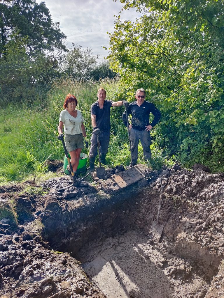
Many thanks to the two Andys for their work on this site and all those who have been involved in some form or other over the years.
One hour later. The local wildlife had returned.
Dig – 16th August
A group of 3 diggers (Andy J, Andy B and Lynn) continued our investigation of the “well” area; Kev, Sian, Helen, Margaret & Dave tried looking for the remnants of the Well House Cottage.
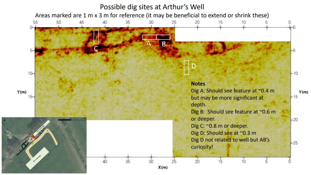
Three possible areas of interest were marked out based upon the GPR survey of the site.
Trench B was opened up first. Approximately 150mm down rubble and stone started to appear. No obvious structure. The GPR had implied that there might be some form of wall going across the trench – but it wasn’t obvious.
Going another 50mm down a large slab appeared – approximately 340 x 400mm. This seemed to be an outlier and, although some larger stones (app 90mm in size), surrounded the slab there was no impression of a wall. After clearing all around the slab, down the the clay layer, the slab was lifted and revealed that it had been embedded in sand. Obviously leveled but with nothing similar nearby. Slightly disappointing.
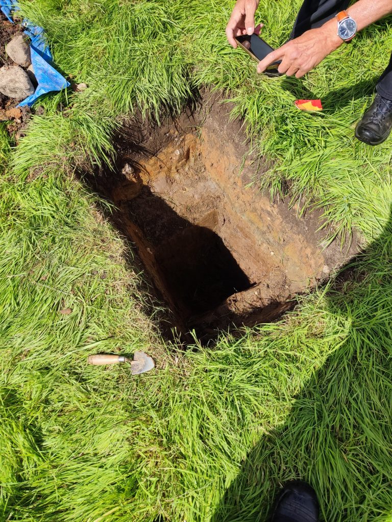
Trench C was excavated by Kev and Sian. At more than 0.8m all they found was the odd stone and clay.
Later in the day, Kev & Sian moved to the middle of trench A. A possible structure was found in one corner.
Overall this site was slightly disappointing. The clay level was close to the surface and it could be that the there was no “proper” foundations and, when the house fell out of use, all the useful material was re-used elsewhere.
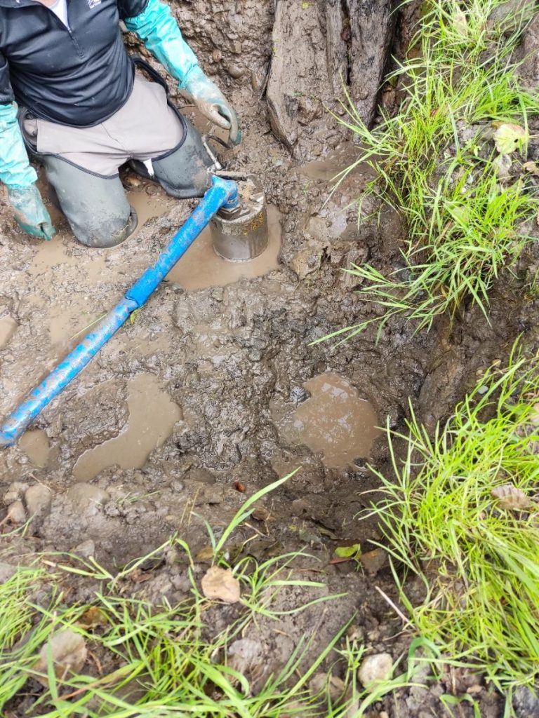
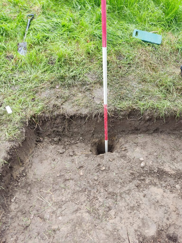
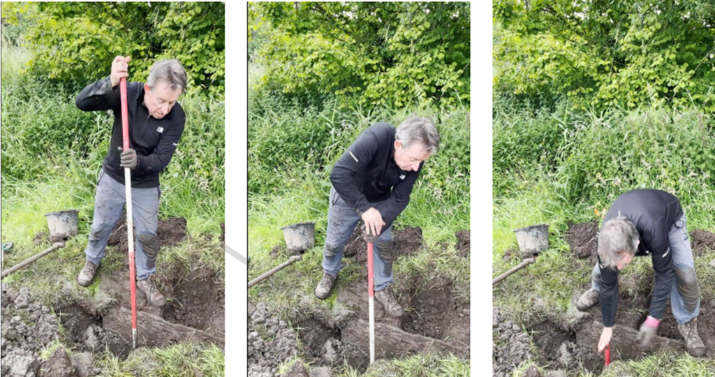
Meanwhile, at the “Well” site it was determined that the main part of the well was on the brook side of the vertical block. A great deal of soil/mud was removed to reveal other vertical stones which enclosed the well itself.
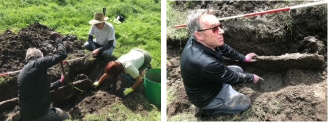
The right-hand photo shows AB pointing to what he thinks is the cap stone for the well. In fact an even larger stone was found underneath this stone.
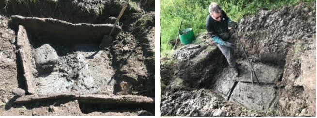
An auger was used to try to determine the structure under the slab. It appeared to be a loose conglomeration of soils, small stones and water.
Below are the diggers responsible.
12th July 2024
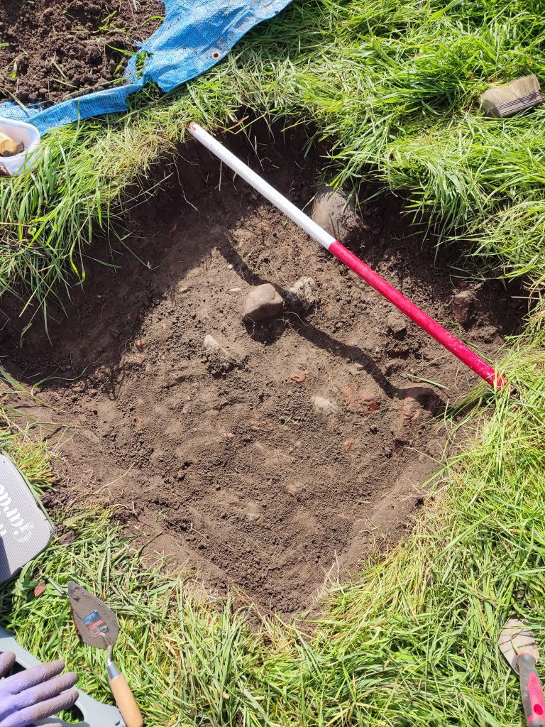
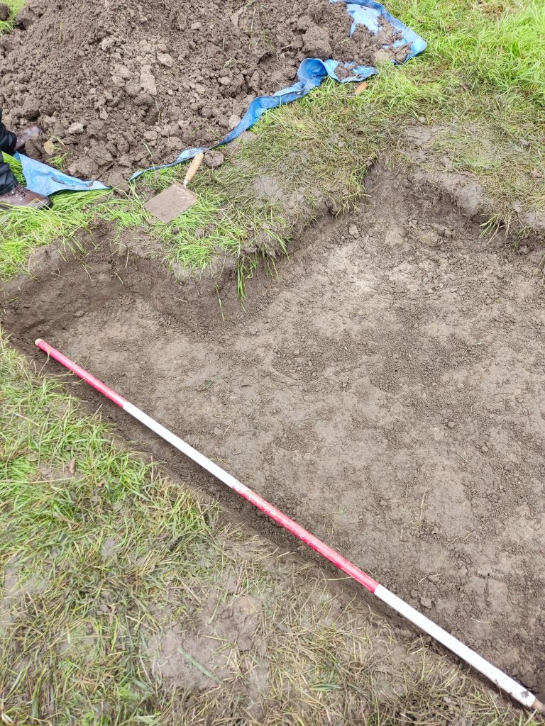
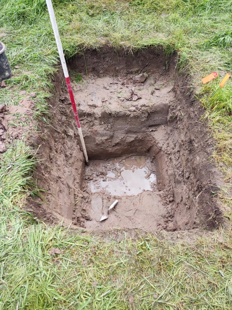
We are returned on the 12th July with Lynn, Helen, Jim, Chris & Dave. Dig site A was the first to be investigated. The turf was removed and, at about 20cm, the soil merged into a clay deposit. There was some variations; the north-west corner was a more sandy clay whereas the rest of the trench was a more conventional clay.
A sondage (shown above) was dug against the southern edge. The clay continued to, at least, 0.8m. It was decided that the geophys was picking up the transition between the soil and the clay.
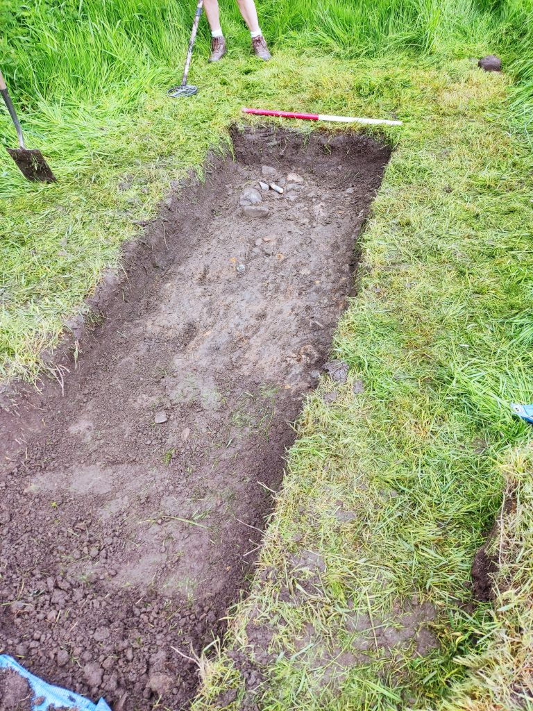
The next trench was cut at right angles to the one marked A on the geophys. There was some success here since it looked like we were picking up the same path discovered on the first dig. Following this there was a suspicion that the path should continue towards trench C. Anther trench was created half-way between A and C. Some stone was discovered but we were unsure as to it being classified as a path. A final trench along this direction discovered no path at all.
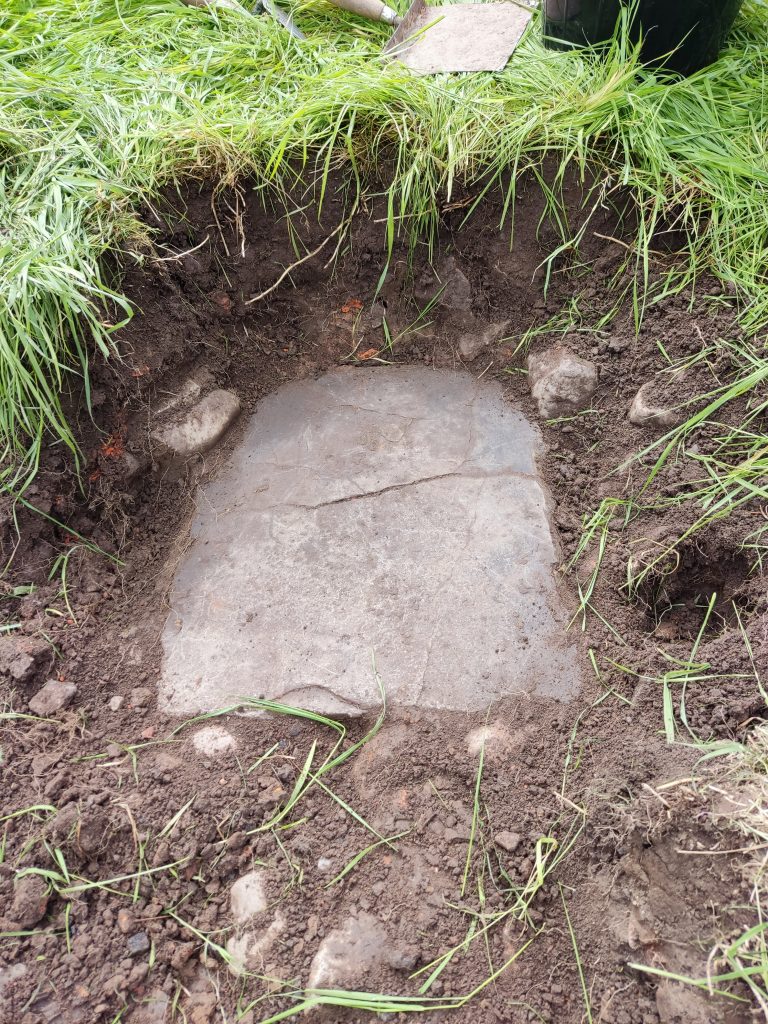
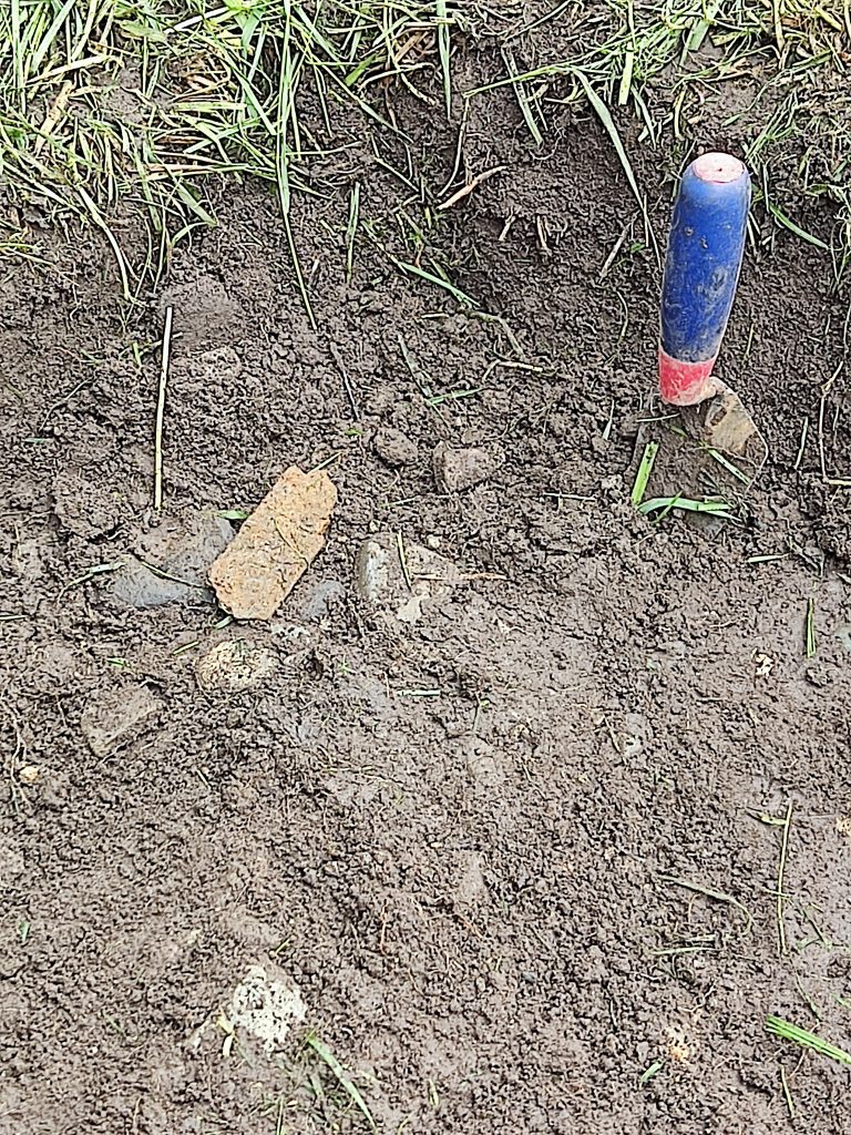
After all of this disappointment we decided to go back to looking at the “known”. The long slab by the side of the path, discovered at the last dig, was re-investigated. Just below the surface (about 5cm) the diggers came across a plaque.
Closer examination gives us this image.
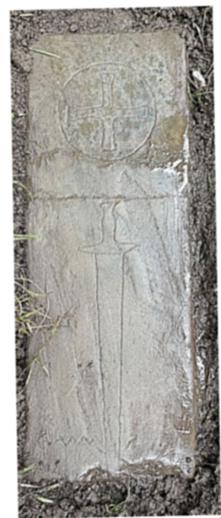
There are a number of problems with this. It was found very close to the surface, the carving is very crude and would have been destroyed with any sort of agricultural use. It looks like it was just deposited as a joke.
Moving on. More investigation took place around the long stone slab. In a very muddy, watery environment the area was probed with a 2m range pole.
We need another dig. More information to follow…
Post Dig Evaluation. There was a worry about how some of the features failed to tally with the geophys. The various reference points were re-measured and, at the moment, it looks like the post used for Ref2 was the wrong post – about 3m away from the correct one.
Update
The grass has been cut. Fortunately the markers showing the edge of the trench, although a little mangled, were still in situ. In early July the site will be marked out again and we will return.
There are a number of “wells” in the vicinity of Goosnargh but the exact actual position of Arthur’s Well, although shown on old OS maps, has been impossible to find. Wyre Archaeology used a combination of old maps along with EM and GPR surveys to pinpoint the well.
On Saturday, 18th May, 2024 in sweltering conditions, a group of 8 Wyre Archaeology members arrived to investigate the site.
The grass on the site had grown enormously so the dig site was strimmed. Site C was chosen initially because of the intriguing, squashed circle shape. Quickly we came down, through the topsoil, onto a sandy, clay layer. By the 0.8m level, where we hoped to have discovered a more substantial layer, water was appearing from the surrounding water table.
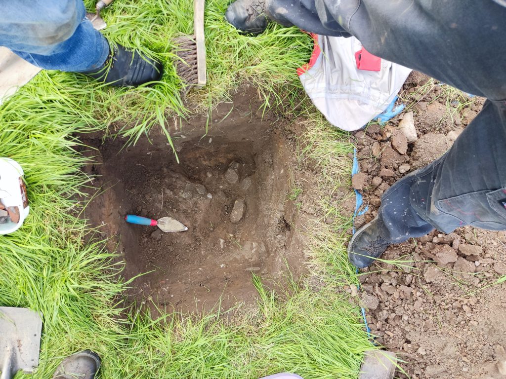
This was slightly disappointing, so site A was strimmed and prepared for digging. Within 20cm of the surface small stones appeared in the top-soil. As the dig progressed, closer to site B, the stones increased in size – looking more like a possible path.
In the top left corner of the above image appeared a long, thin piece of sandstone which seemed to continue into site B.
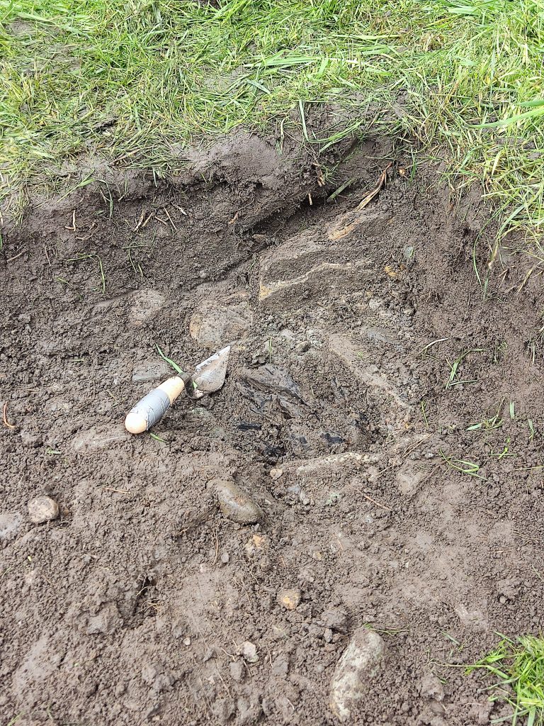
Just to the right of the trowel a piece of carbonized wood was revealed.
Our first find appeared in this layer – a rusty piece of metal.
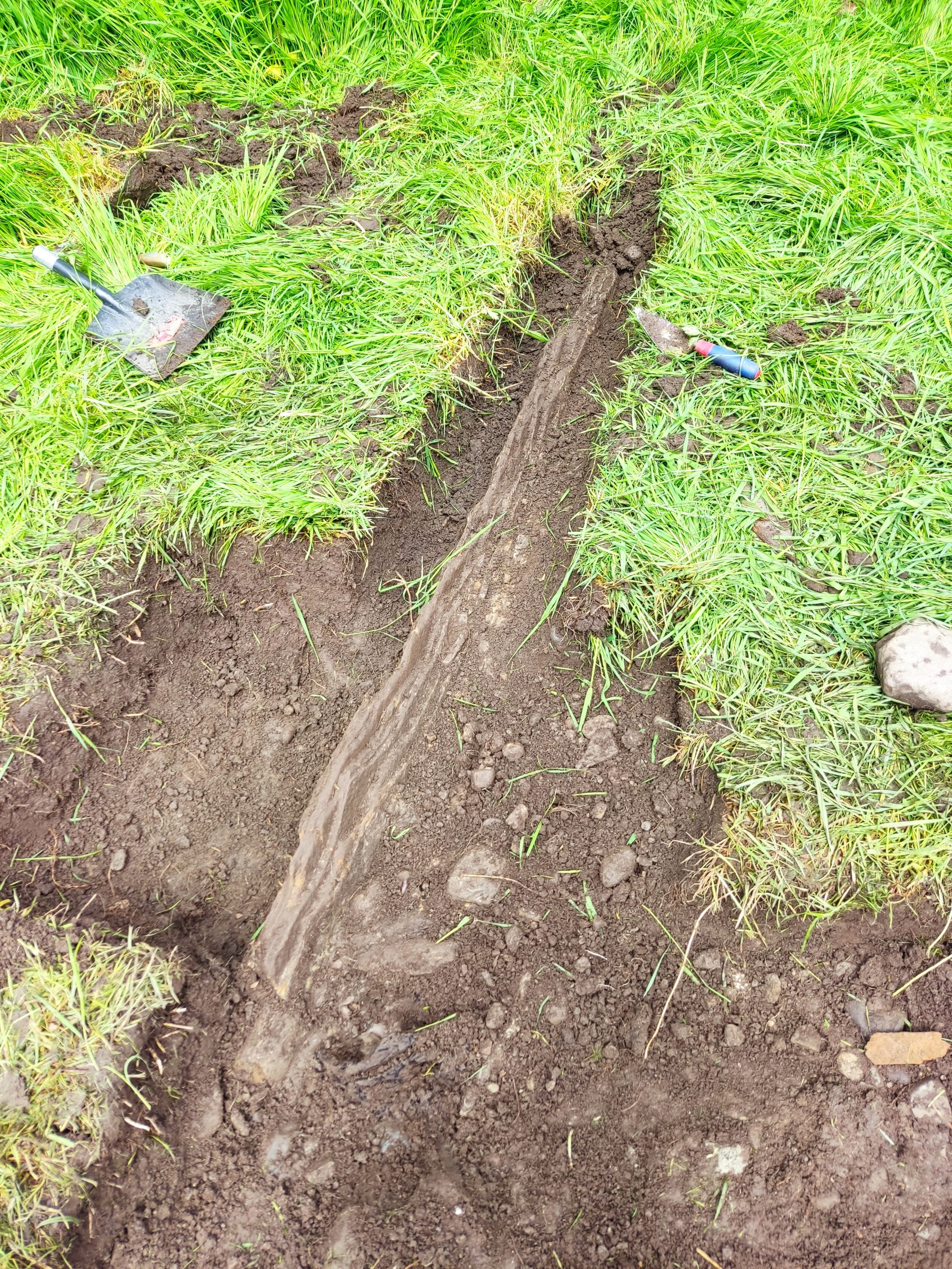
The thin sandstone block was then partially excavated.
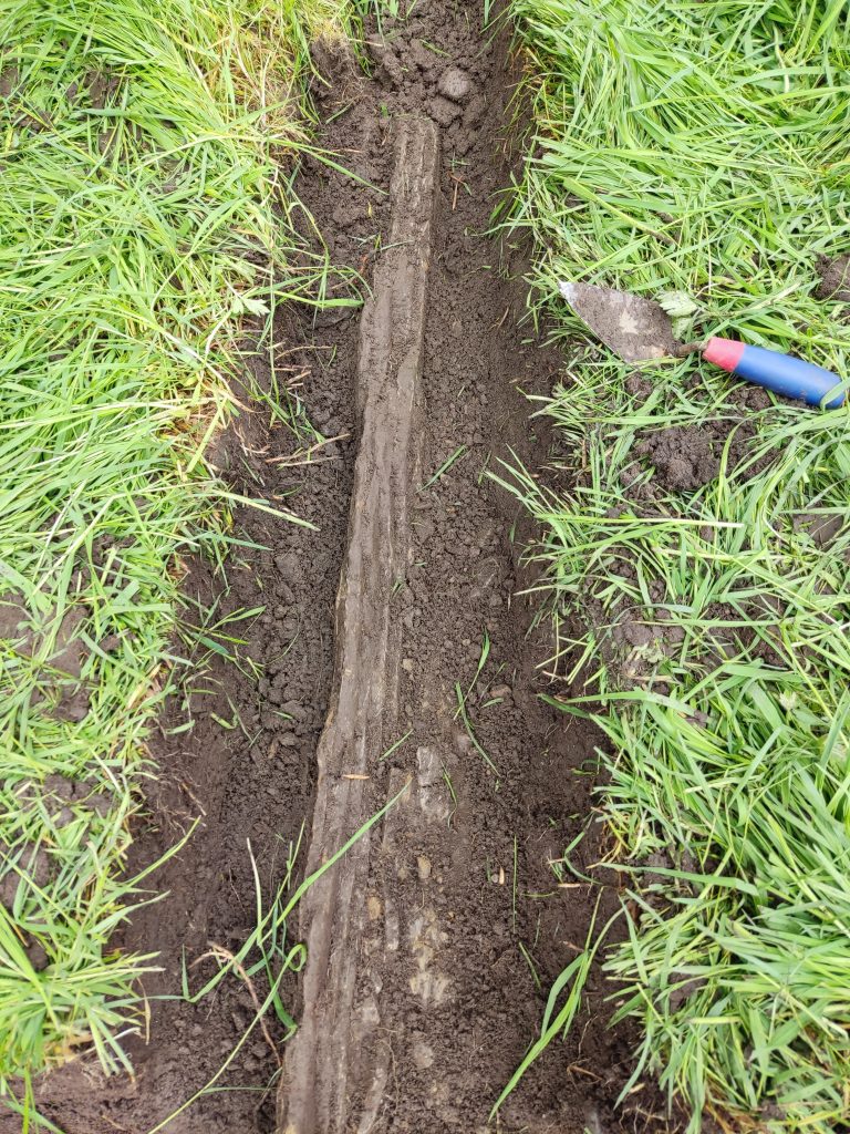
Approximately 1.68m in length. Was this the edge of the well? Was this just a piece of edging for the track. Another visit is needed to satisfy our curiosity.
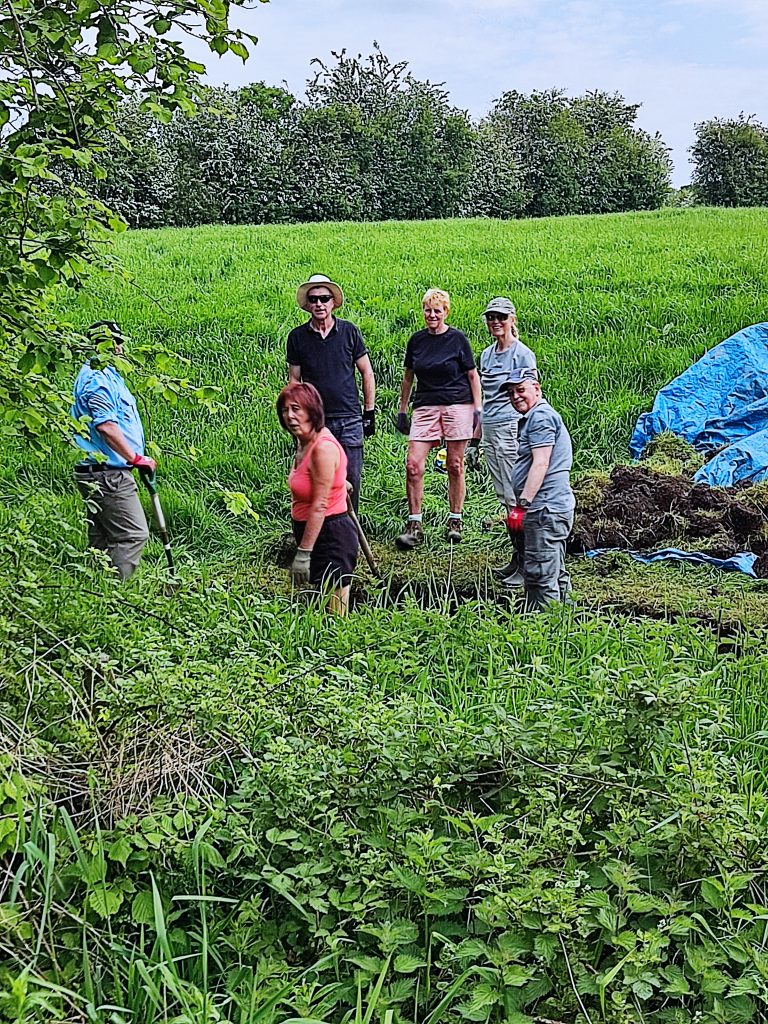
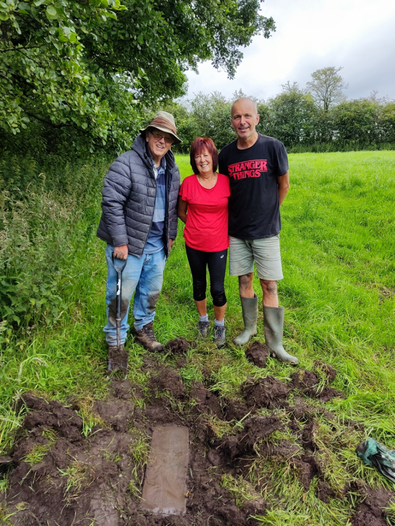
Many thanks to all those involved. Andy J, Andy B, Mike, Helen, Lynn, Nic, Jen, Michael & Dawn.
As you can see from the above photograph the vegetation was a problem. The grass is going to be cut over the next two weeks and we hope to return early in June.