It is common knowledge that a Roman road existed in the Lune valley – in fact it has been uncovered in several places. Various suggestions as to the actual route have been suggested but the use of Lidar maps and their interpretation by a couple of our members (David Ratledge and Andy Jackson) indicated several possible routes. The nearest to the centre of Lancaster that could be investigated was just off Ridge lane to the east of Lancaster.
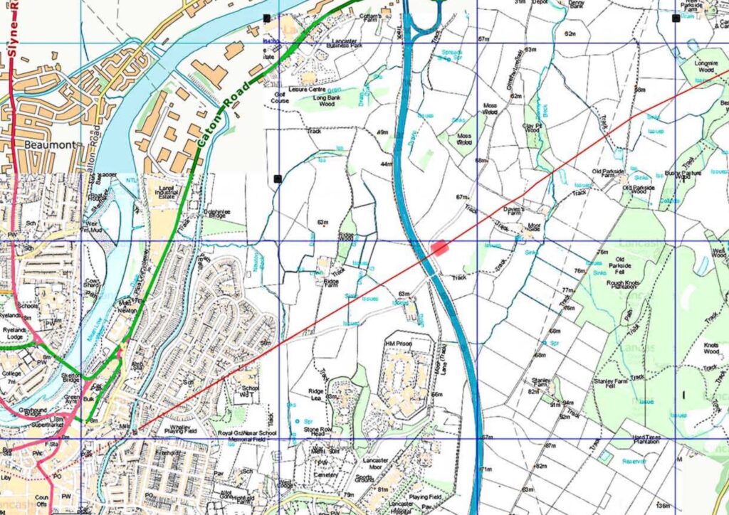
The “suspected” route, from Lidar, is shown as a red line (courtesy of David Ratledge – Roman Roads https://www.twithr.co.uk/) . The dig area is shown as a red rectangle.
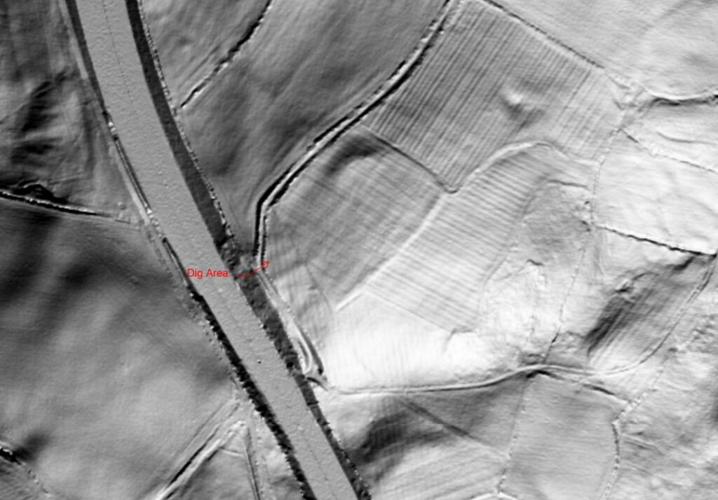
Lidar image, shown above and courtesy of Nic Roberts, points out the dig area complete with a couple of features pointing in the correct direction – up the Lune valley.
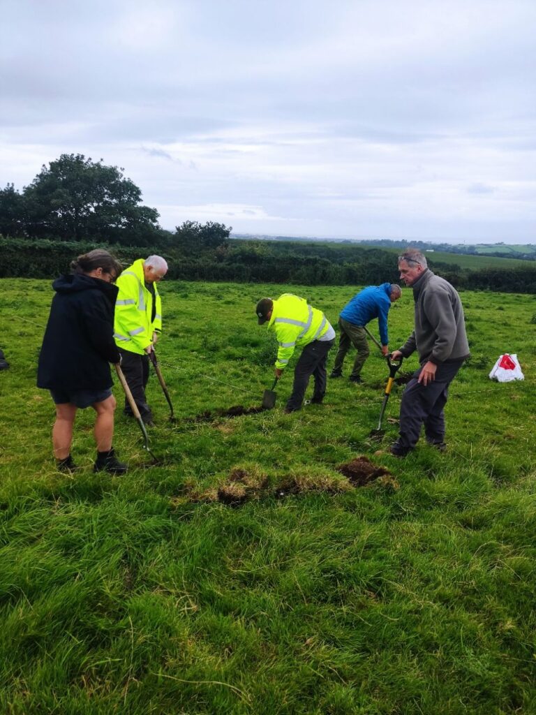
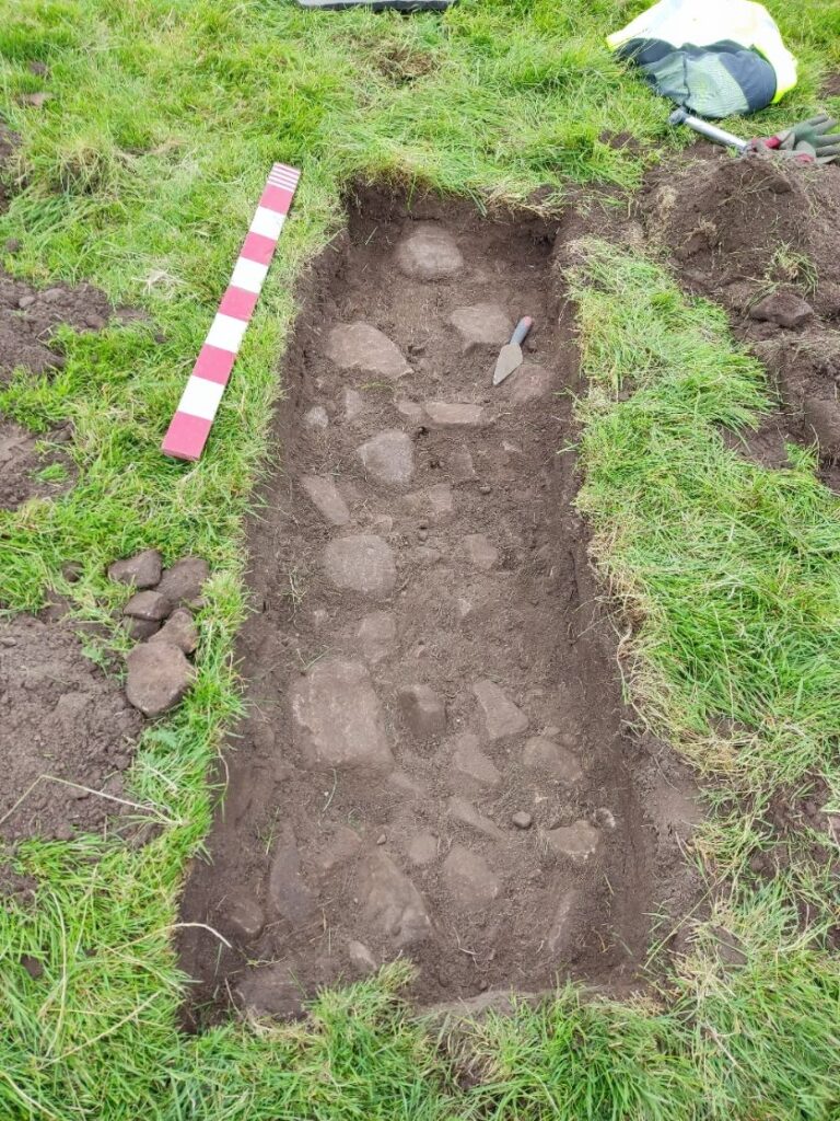
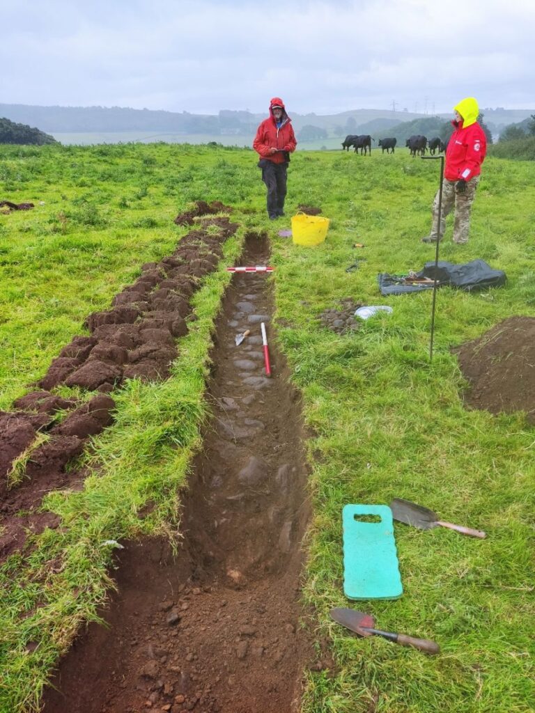
On the 9th August, 2025, Wyre Archaeology decided to investigate this site. It was decided that a long trench cutting the lidar feature would “capture” any road. Below is an image of the site as the first trench was opened.
Almost immediately a stone surface was revealed about 12-15cm down.
The trench was extended at both ends trying to determine the extent of the surface. Much to our surprise the surface extended well beyond 7-8m (typical for a Roman road) with no obvious drainage ditch to terminate the feature.
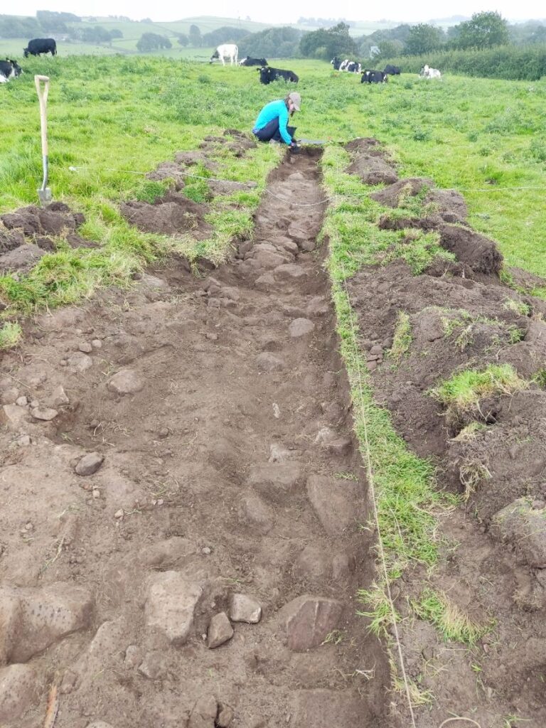
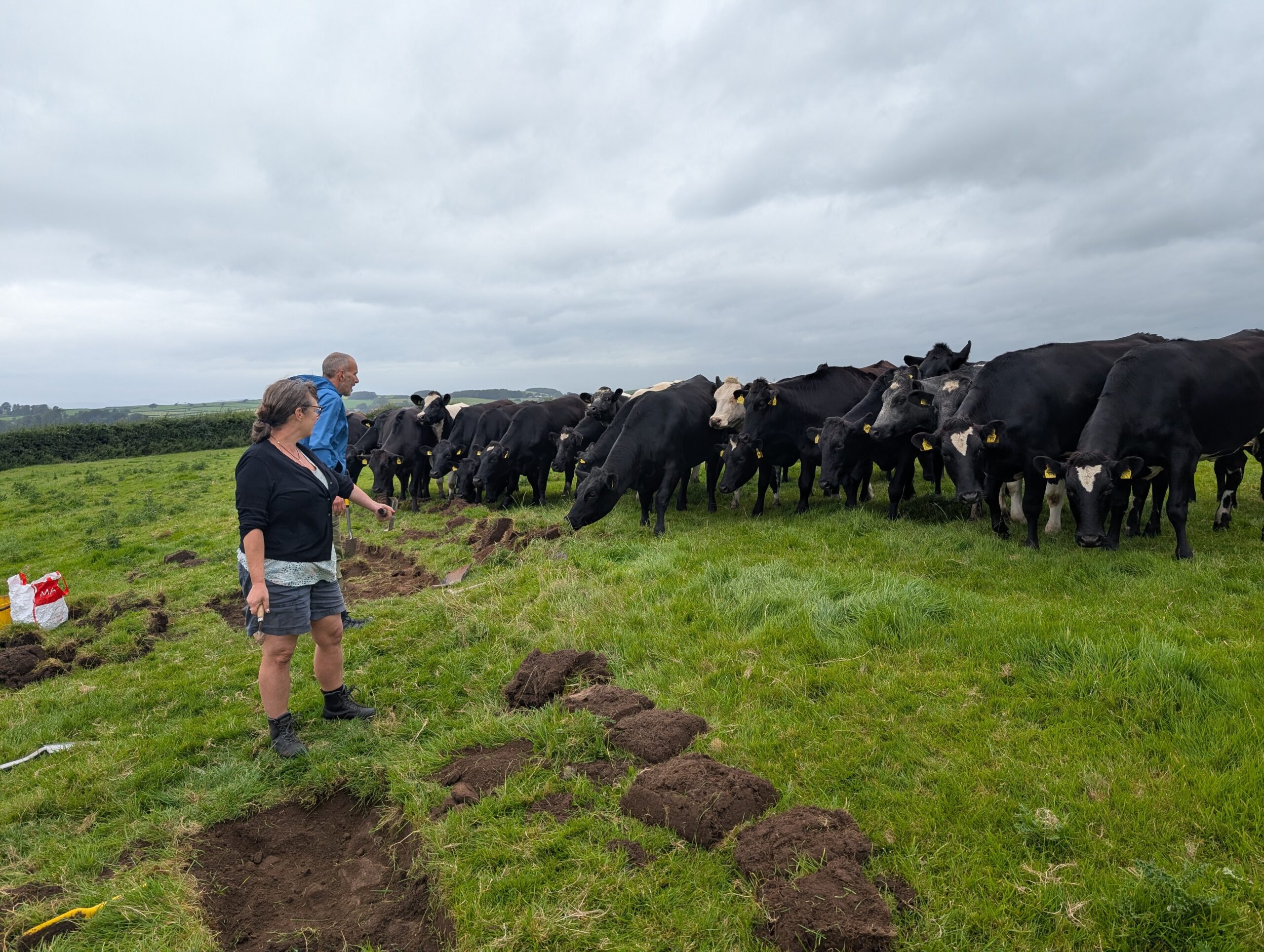
By this time we had gathered some interested bystanders.
At the same time another trench was opened, closer to the hedge (25m). In principle it should offer a less disturbed site.
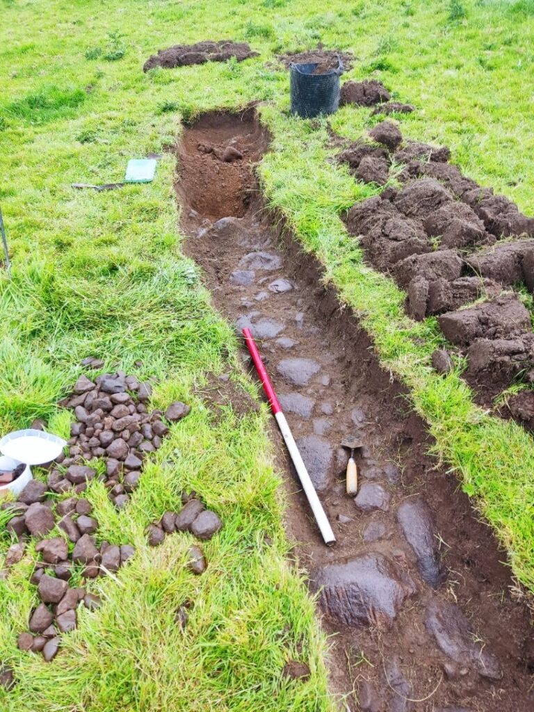
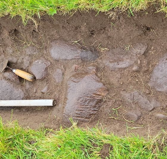
Although similar sized stones to those uncovered in trench A were revealed they were more tightly embedded. More importantly a ditch was found at the ends and the surface was around 7.5m.
Some of the stones showed plough marks at right-angles to the road surface – just as you would expect from the lidar ridge & furrow lines. The fact that a plough couldn’t move them was also encouraging that this was the real road surface. What3Words gave the centre of this trench as “purchaser.polishing.spun” and a grid reference of SD49795 62938.
There was much discussion regarding the route of the road over the field. A group of large stones were uncovered near some large trees about 200m away from the dig site. Where they part of the road? Possibly to be answered sometime in the future.
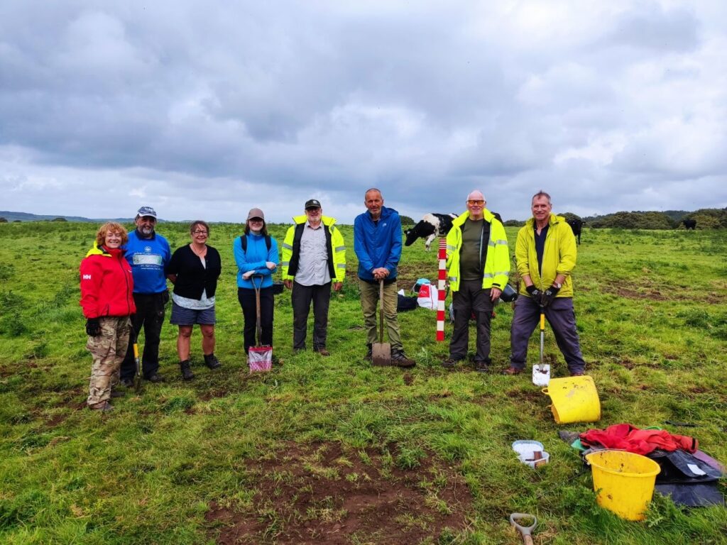
Diggers, from left to right. Sian, Kev, Paula, Jenny, Nic, Jim, Simon and Andy. Helen had to leave early and Dave took the photo. All other photos courtesy of Kev & Simon.
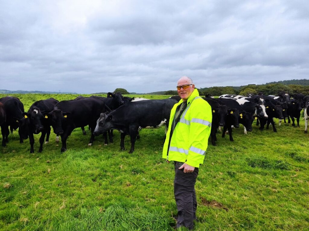
Also thanks to James Park, the tenant farmer, for permission to excavate on the land.
An aerial image from 1945 provides an interesting view of the area.