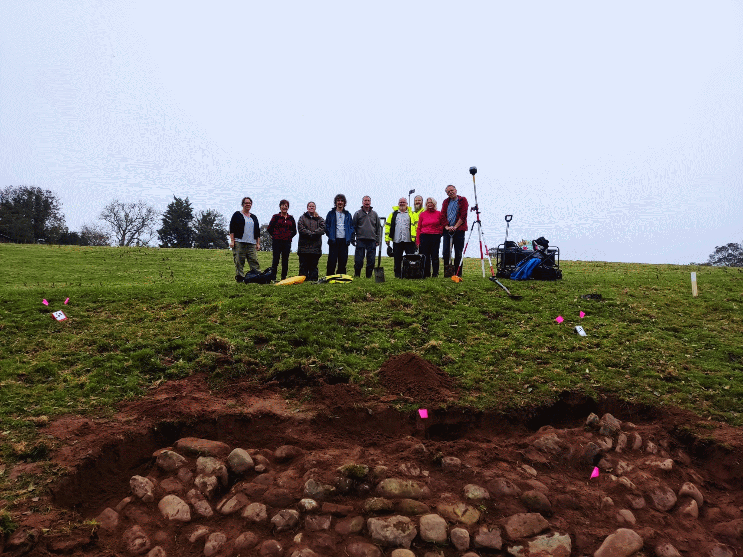
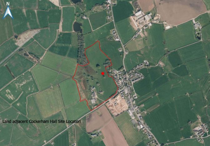
On Sunday, 12th October, sixteen members of Wyre Archaeology set out to investigate a number of interesting features at Cockerham Hall. Prior to the visit, old maps and lidar images had indicated that the area might provide a fruitful hunting ground.
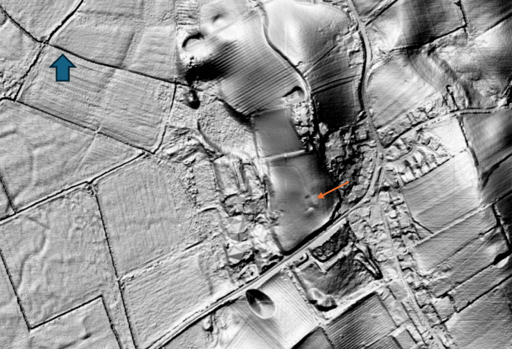
On first sight the lidar image looks slightly confusing but in a field above the hall, marked with the red arrow, an “out of place” rectangle appears. This would be the main focus of our investigation.
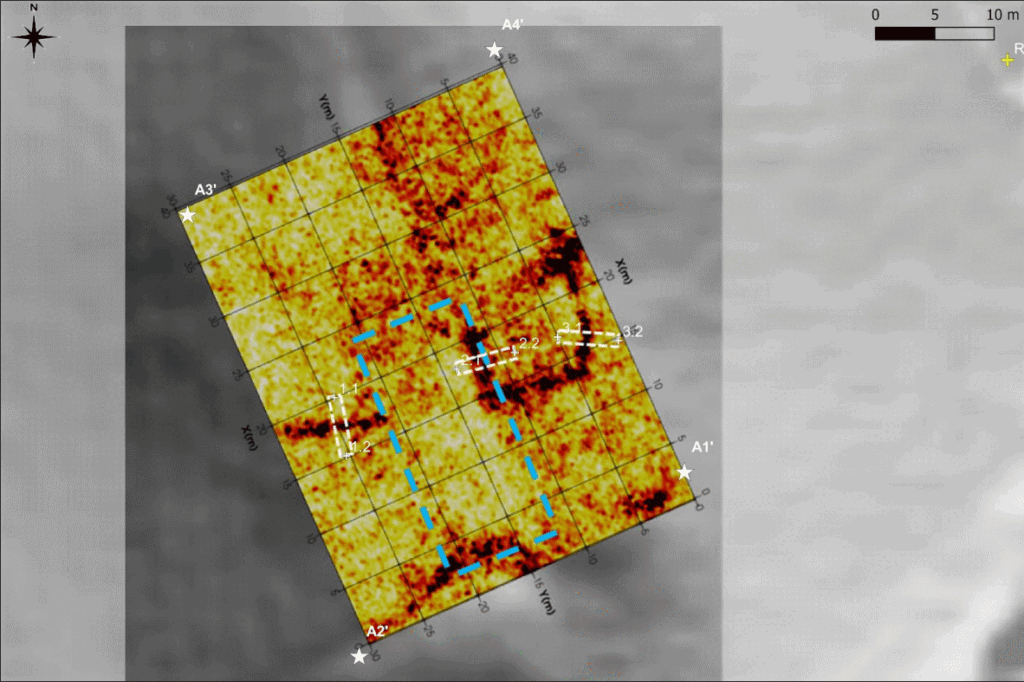
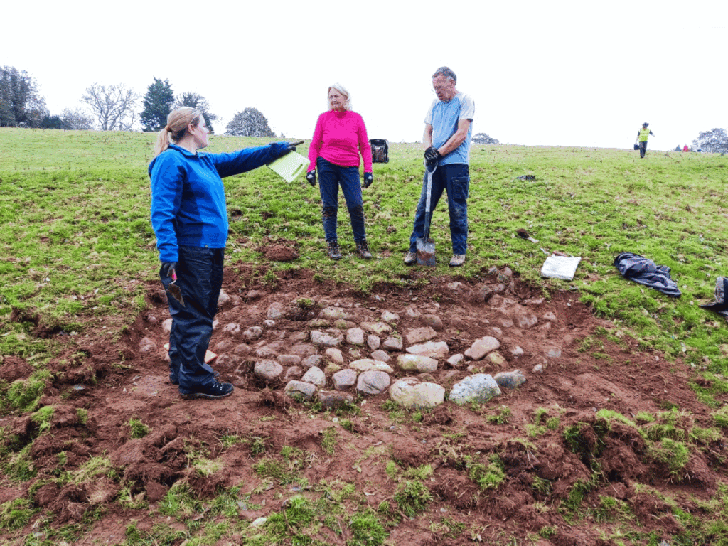
GPR was used to cover the site and the resulting image at 1.1m depth seems to reveal a discontinuity in a lateral feature. Three 5m trenches were opened. Almost immediately, within 20cm, all of the trenches encountered small cobbles.
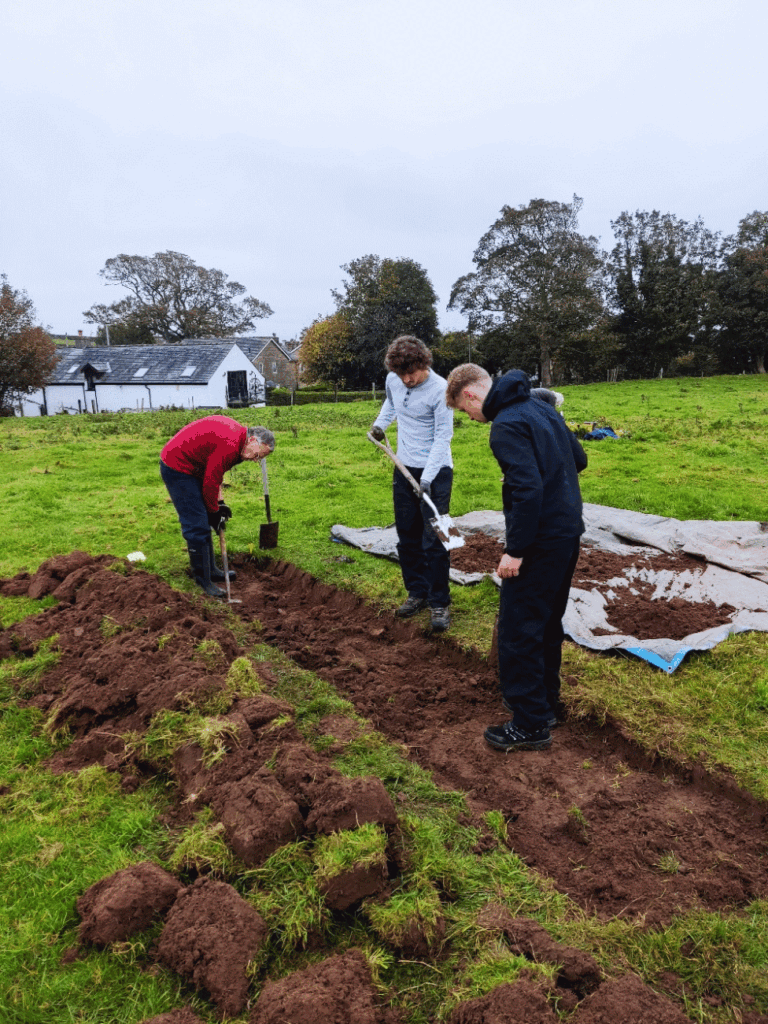
The above image shows the early stages of trench 3.
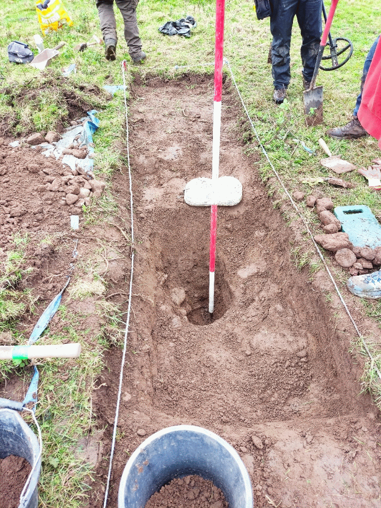
All three trenches were taken down to >1m looking for any changes in the structure but nothing obvious appeared. Trench 1 had a possible lateral cobbled area corresponding to the GPR line – a possible early path or shallow boundary of stones.
Some of the uncovered cobbles can be seen at the side of the trench.
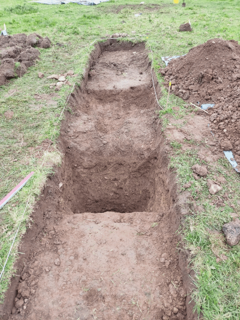
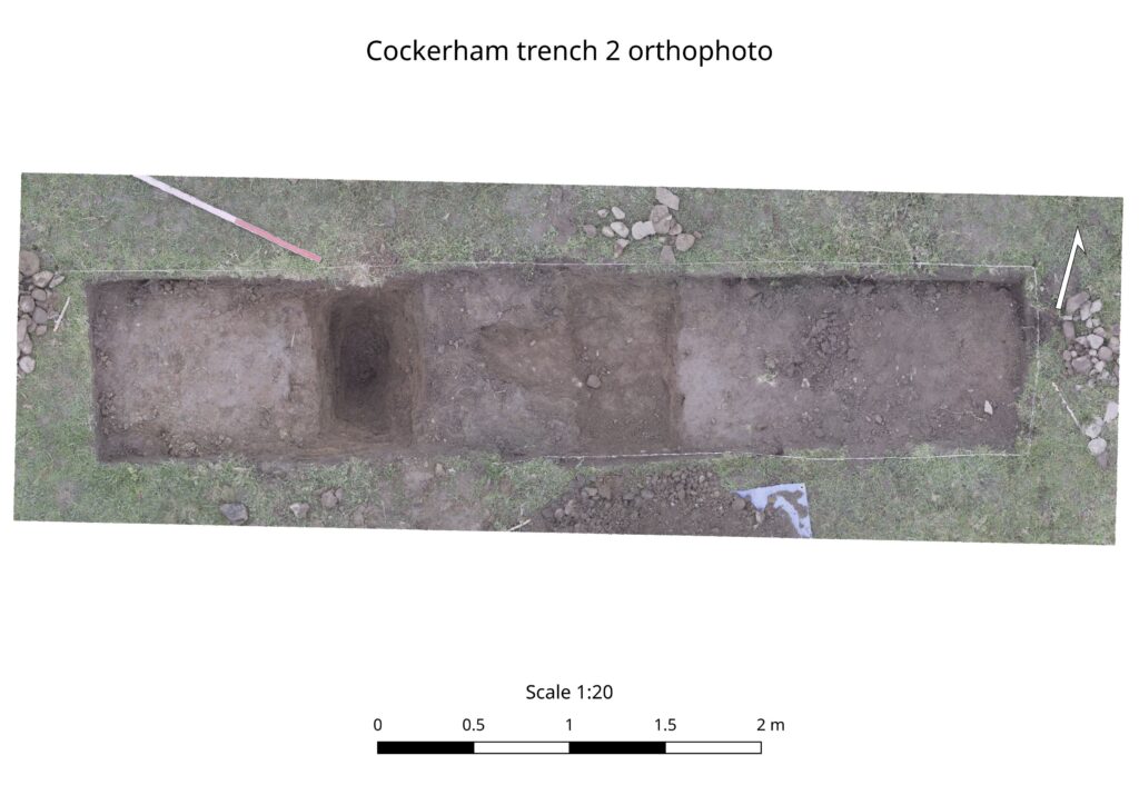
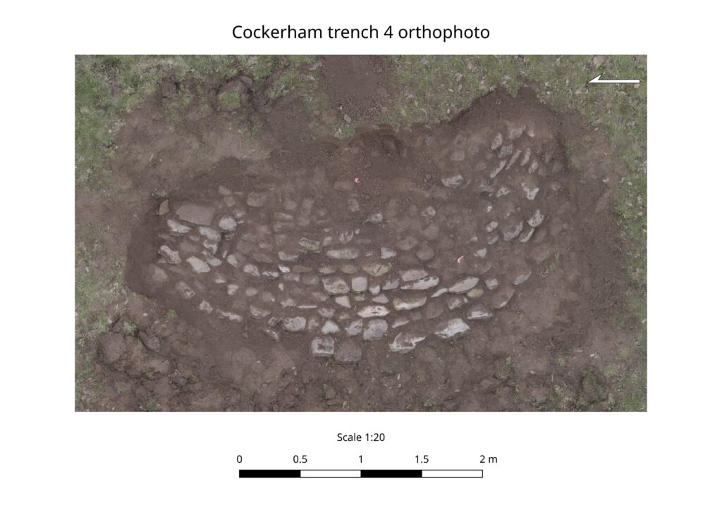
Trench 2 was favourite for revealing any discontinuity but nothing was uncovered. John has produced an orthophoto of this trench – shown below.
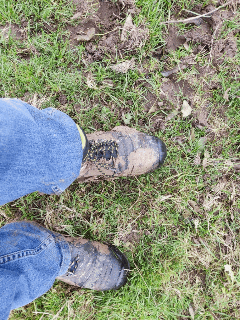
Trench 3 descended onto clay layers at about 0.6m. Shown below on my boots the remnants of trying to dig into the clay at 1.2m
Because of the extra numbers some diggers were released to investigate other areas of the site.
Helen took the opportunity to metal detect on the site and came up with a button complete with crest.
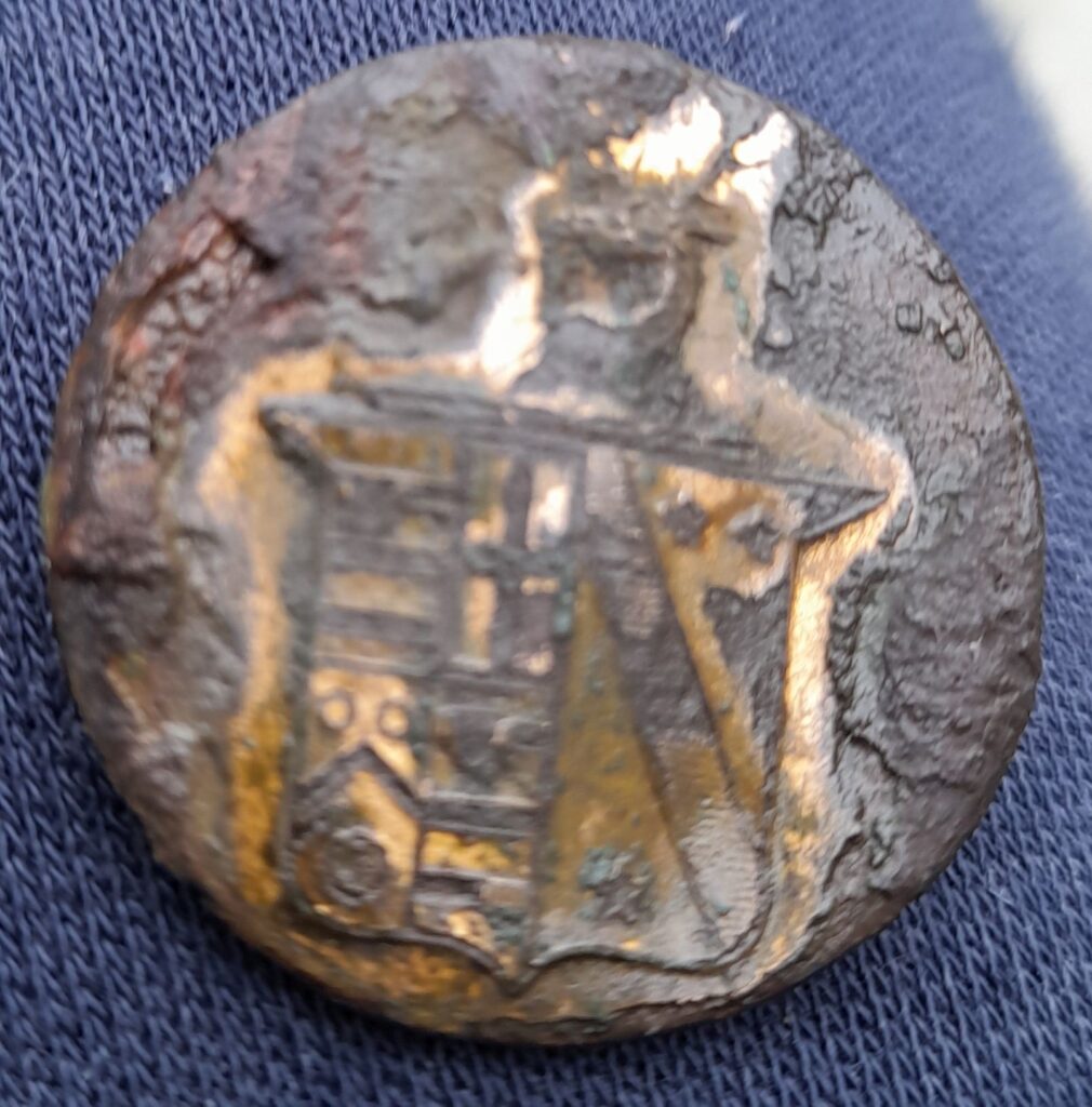
If anyone recognizes the crest can they please contact our secretary.
The image below shows various area of interest and will be referred to further down the blog.
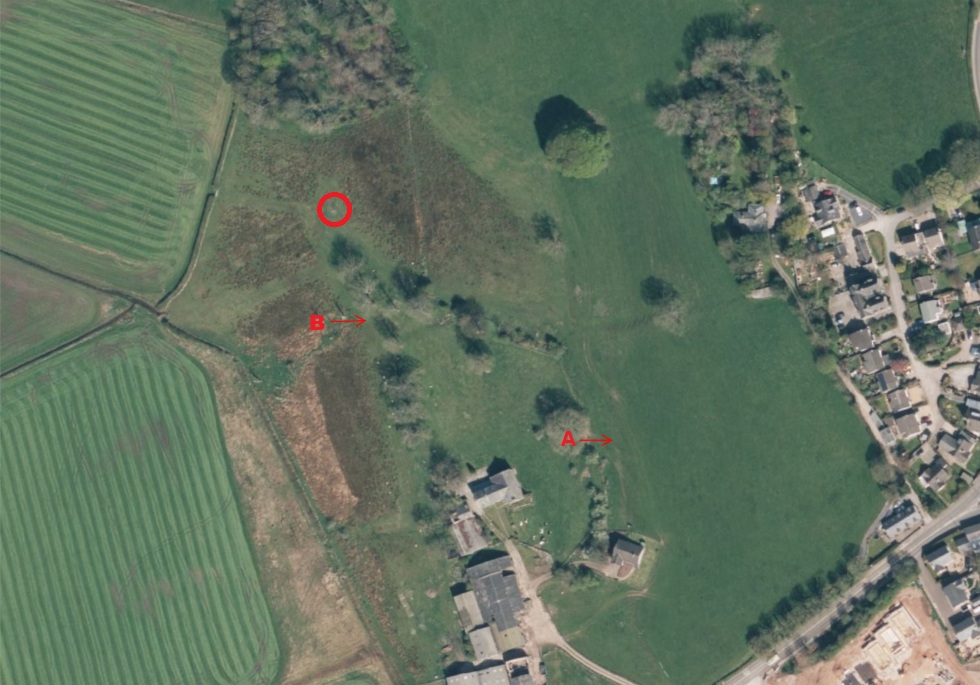
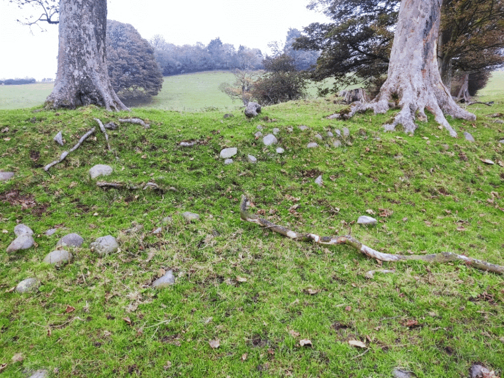
Closer to the main hall a possible sea defence was uncovered – though every digger seemed to have their own view about its purpose. This is marked “A” in the above image.
Interestingly this was above the site of hall so, if it was ever used for protection from sea incursions the hall would already have been flooded.
An orthophoto of this trench reveals a more circular structure.
Further examination of the land revealed more features. An earlier sea wall can be seen in the image below. Marked “B” in the previous image.
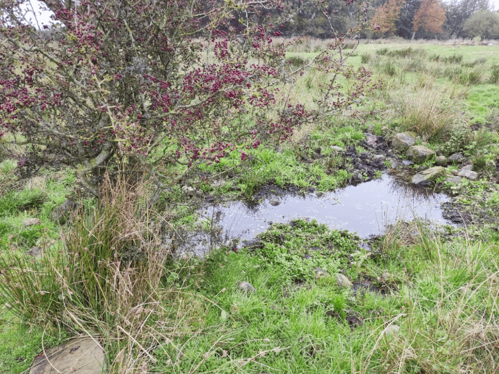
Further around the site was a spring/well.
Again, worked stone demonstrated that this area had been developed some time ago. More worked stone (two pieces) were uncovered on the north of the site – well away from the Hall. As far as the blogger is concerned the most interesting find was partially uncovered “wall” between the swampy area and the open, reclaimed land. Marked with a large red “O” since the exact position on the map is inexact.
It is difficult to see in this image but it appears to to be a wall with the face facing away from the sea – as if it was enclosing something on the landward side! Why? More investigations required.
Andy J has provided a cleaned up image of the above wall. Shown below.
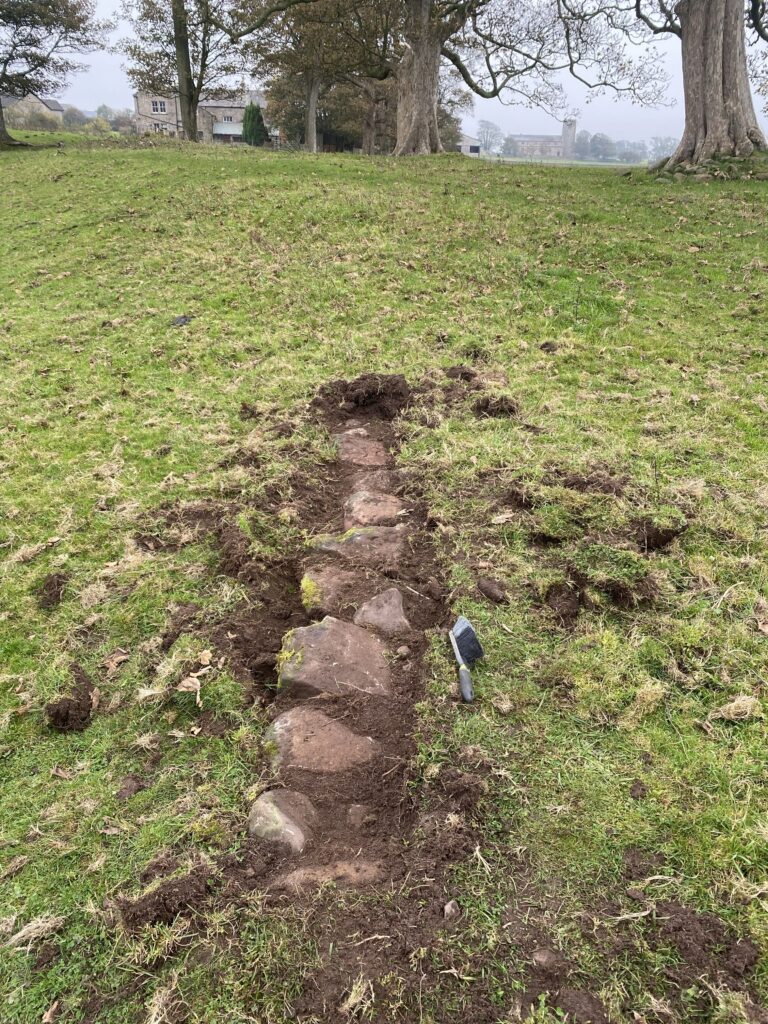
Brush for scale. No banana available.
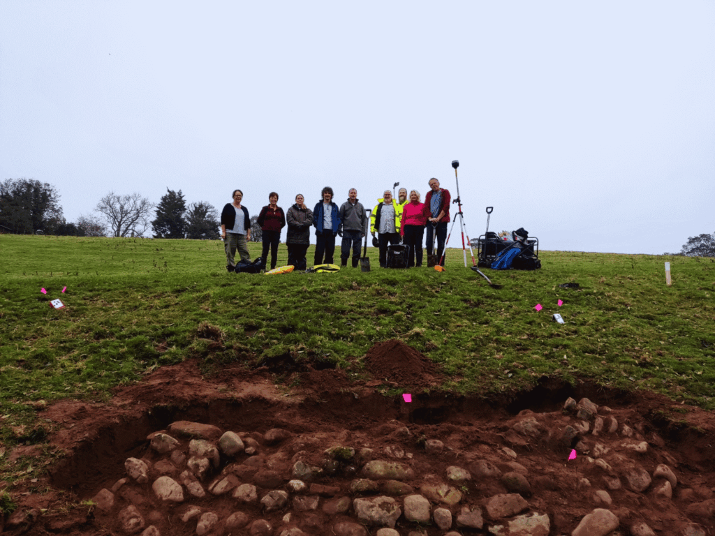
A small contingent of the diggers appear in the above photo but all our thanks go to Eric, Liz, John, Helen, Andy J, Sian, Kevin, Joseph, Terry, Dawn, Paula, Lynn, James, Andy B, Dave and Nic.
Many thanks to Nic & Jen for organizing the dig – not to mention Andy J for the discovery/liaison, Andy B for all the work with GPR and EM and John for the drone work.